
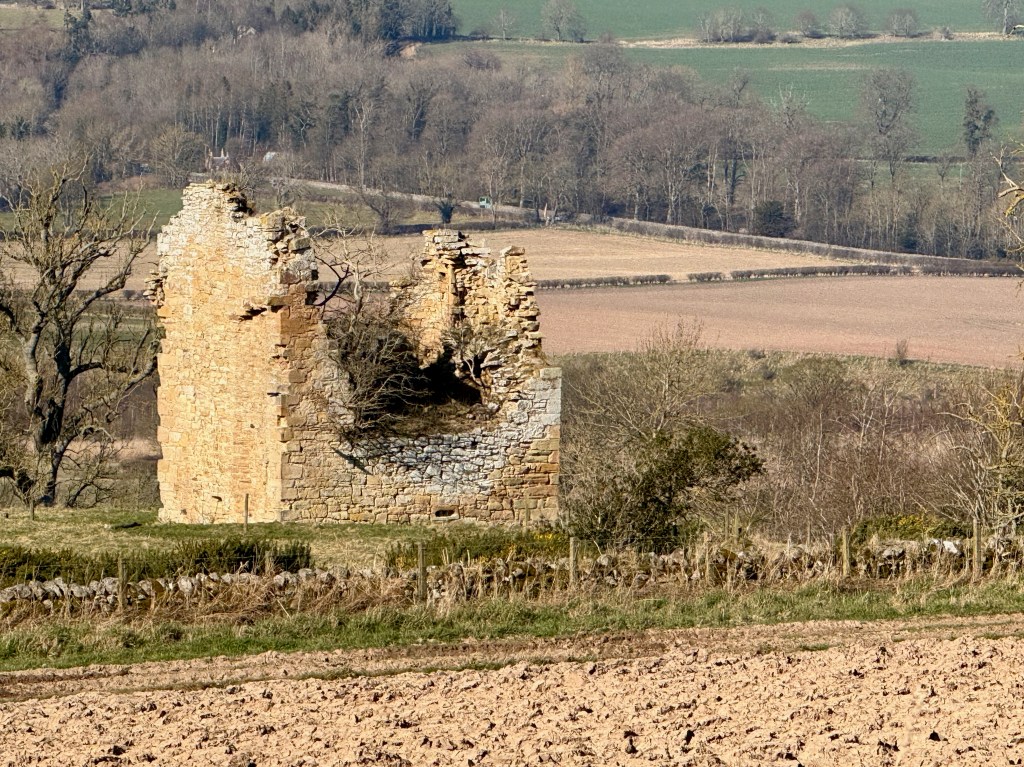
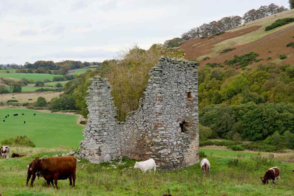
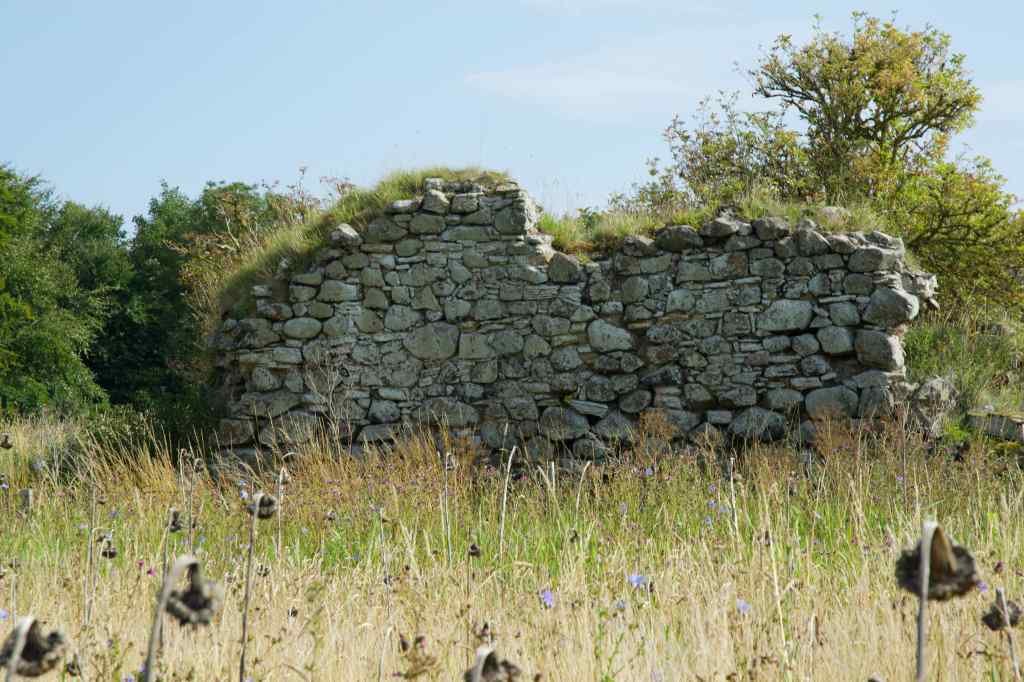
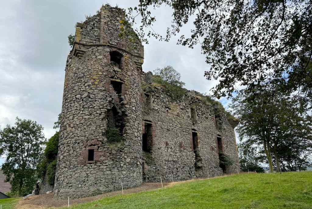
This ruined 16th-century Tower House occupies a lonely spot on the western slope of Lanton Moor, approximately 1.5 miles (2.4 km) north west of Jedburgh. The tower, which is surrounded by older earthworks, originally reached a height of four storeys. Its position had some natural defensive advantages, being on rising ground between the River Teviot and Jed Water.
The name Timpendean, originally called Tympenden, derives from the Celtic terms din pen denu meaning “the valley by the hill with the fort”
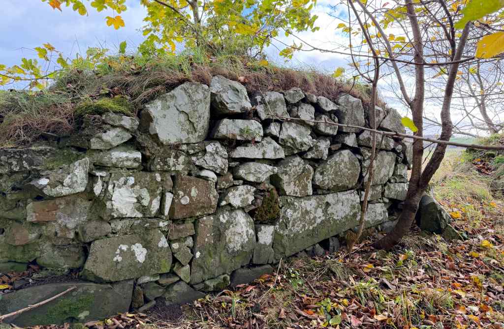
Built of yellow and cream sandstone rubble, the tower measures almost 9 metres by 7.5 metres, with walls 1.4 metres thick. It was a substantial structure.
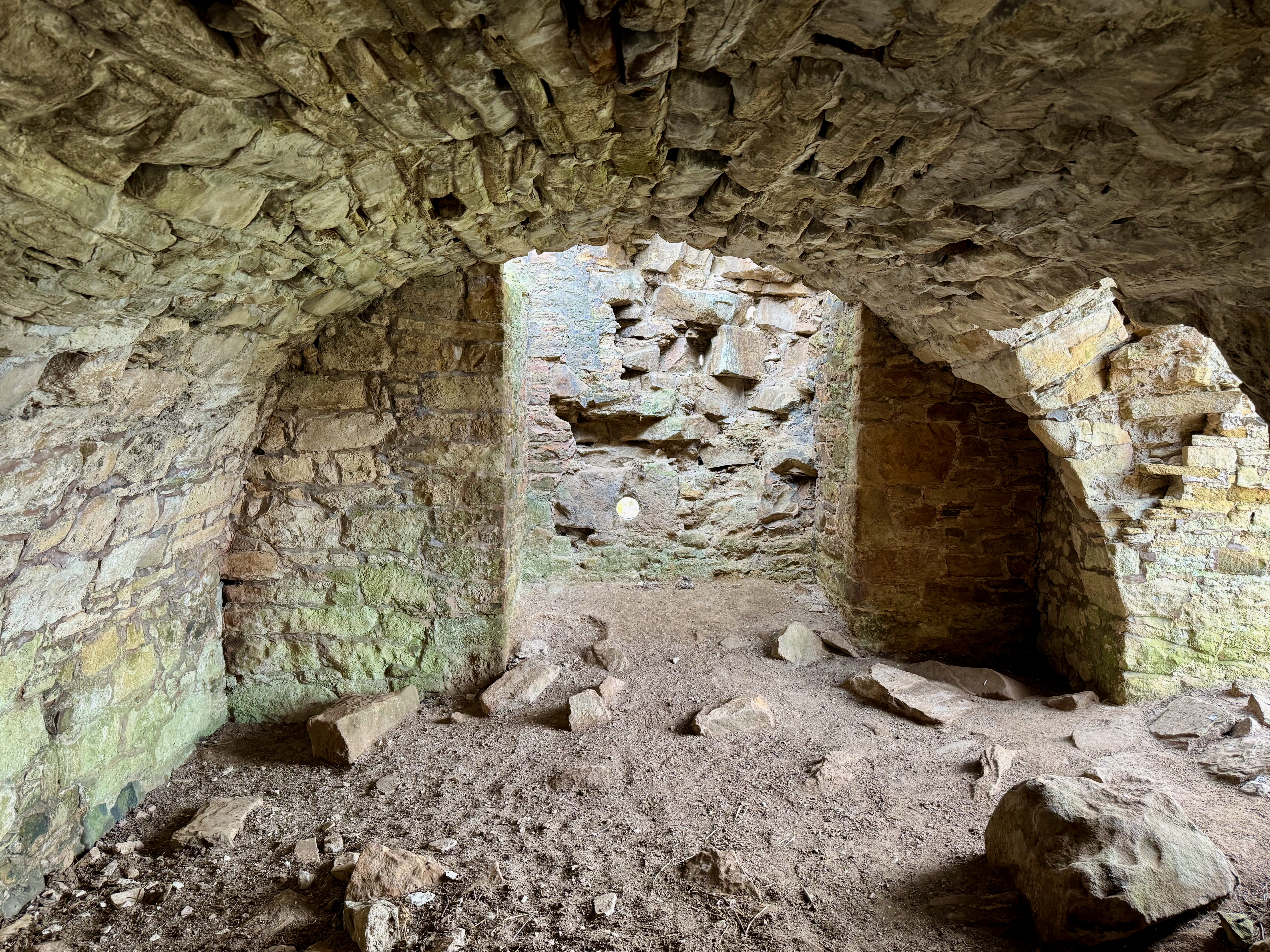
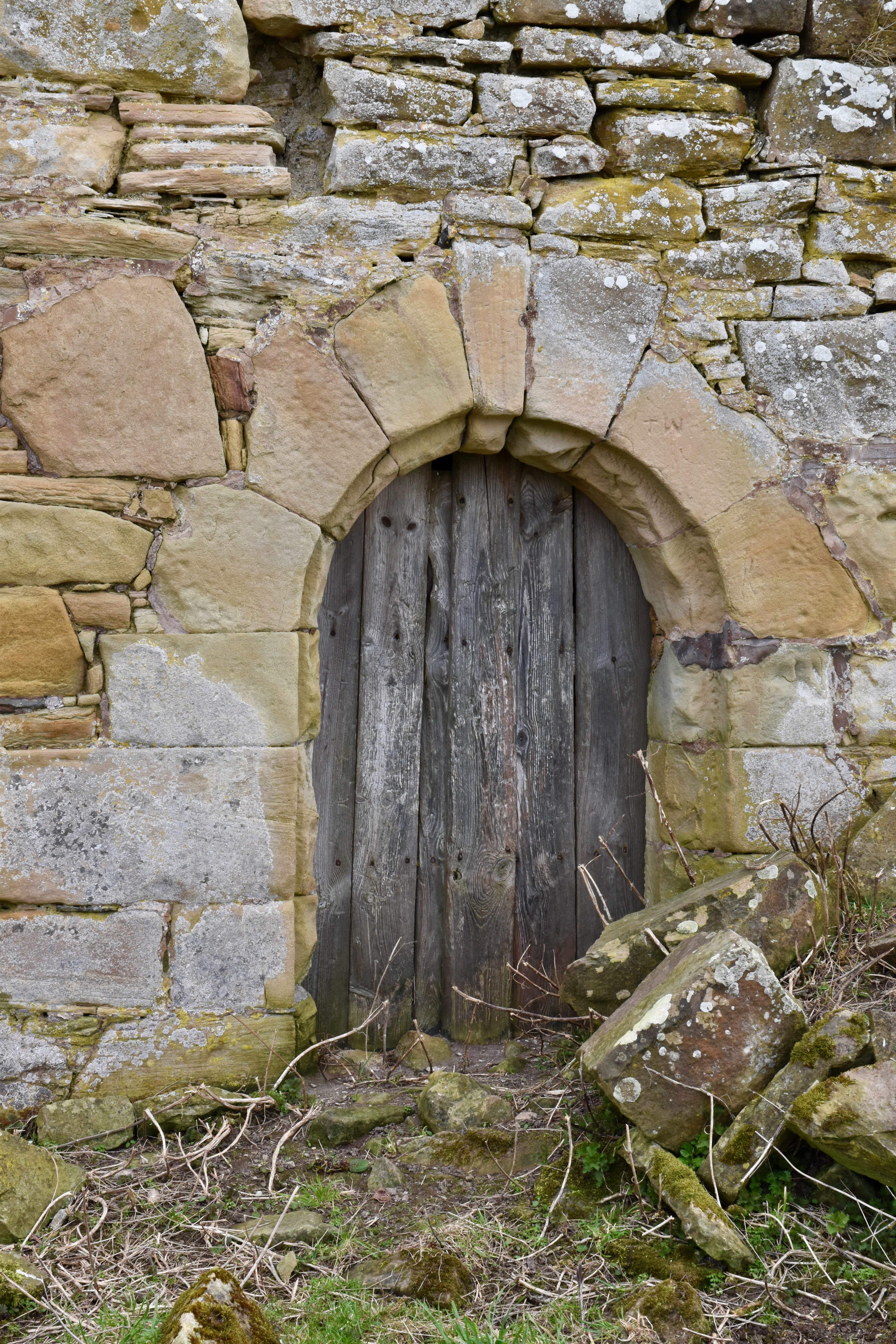
The original entrance, which features a semicircular arch with an outer door, faces northwest, but another entrance was broken through the northeast gable in the 17th century. Two gun-loops survive on the lower floor, while a third was enlarged to form a window in the 17th century.

The original entrance opens into a vaulted cellar, on one side of which is access to the stairwell. This chamber was originally a storehouse but later became a kitchen. The hall, located on the first floor, features a fireplace remnant on the west wall. The upper floors would have been the sleeping quarters.
One of the most intriguing aspects of Timpendean Tower is its proximity to much older earthworks. These are thought to be from the early Middle Ages. The surviving defences comprise various configurations of ramparts and ditches on different sides of the perimeter. Adding to the tower’s defensive capabilities, one of these ditches would have been filled with water.
Timpendean Tower is associated with the Douglas Lairds of Bonjedward. The lands were originally granted to Sir James Douglas in 1320 by King Robert the Bruce and were held by his descendants for more than 500 years.
In 1479, George Douglas, 4th of Bonjedward, passed Timpendean over to his younger son, Andrew. Then in 1540, William Douglas, heir of the late George Douglas, received a charter from James V, which included the lands of Timpendean.
But what of its association with historical events?

We know that towers such as Timpendean were common throughout the Borders because of the prevailing lawlessness and the need for protection against raiding parties, particularly Border Reivers.
The Douglas family’s power may have made them targets for reiving (raiding), necessitating the defensive tower, but it would also have positioned them as participants in the border power dynamics. Certainly, the wider Douglas family were one of the major Border names in Teviotdale and the Jed Forest. That meant they could quickly raise mounted men, enforce family interests through feuds and retaliation, and influence local politics in a region where formal royal authority was often weak.
So while not every Douglas was a reiver in the narrow sense of a cattle-raider, the Douglas influence would have helped define the environment in which reiving flourished.
But the best documented historical event occurred at the hands of English invaders in 1545 as a result of Henry VIII’s “rough wooing”. This was a violent attempt to force a marriage agreement between the infant Mary Queen of Scots and Henry’s 6-year-old heir, Edward. Timpendean Tower was one of many attacked and burnt by Edward Seymour, Earl of Hertford, as part of a systematic “scorched earth’ policy.
Hertford’s 1545 expedition moved rapidly through the Borders and struck religious houses, villages, and local strongpoints. Timpendean suffered extensive damage and was one of many fortified residences attacked in that wider operation.
But despite being seriously damaged, Timpendean Tower was eventually rebuilt by the Douglas family in the seventeenth century, and was augmented by a new wing. The vaulted basement was converted into a kitchen with the substantial fireplace still visible today. However, the extension was later demolished leaving just traces of its prior existence.

It remained a Douglas seat until it was later sold to William Kerr, Marquis of Lothian, in 1843.
Timpendean Tower is just about visible from the main A698 road. It can be reached on foot by walking about 1 km up a farm track from the road. It is uphill on an uneven surface, and on the approach to the tower, there is a stile giving access over a fence into the earthworks. If it has been raining, the ground will be muddy and the uphill walk hard-going.
Timpendean Tower is an interesting ruin, offering a valuable insight into border life and architecture. Despite the obvious damage, it is certainly worth a visit.
Further reading:
Alistair Maxwell-Irving, 2014, The Border Towers of Scotland 2 (Maxwell-Irving)
Mike Salter, 1994 The Castles of Lothian and The Borders (Folly Publications)
Ancrum & District Heritage Society


Leave a comment