
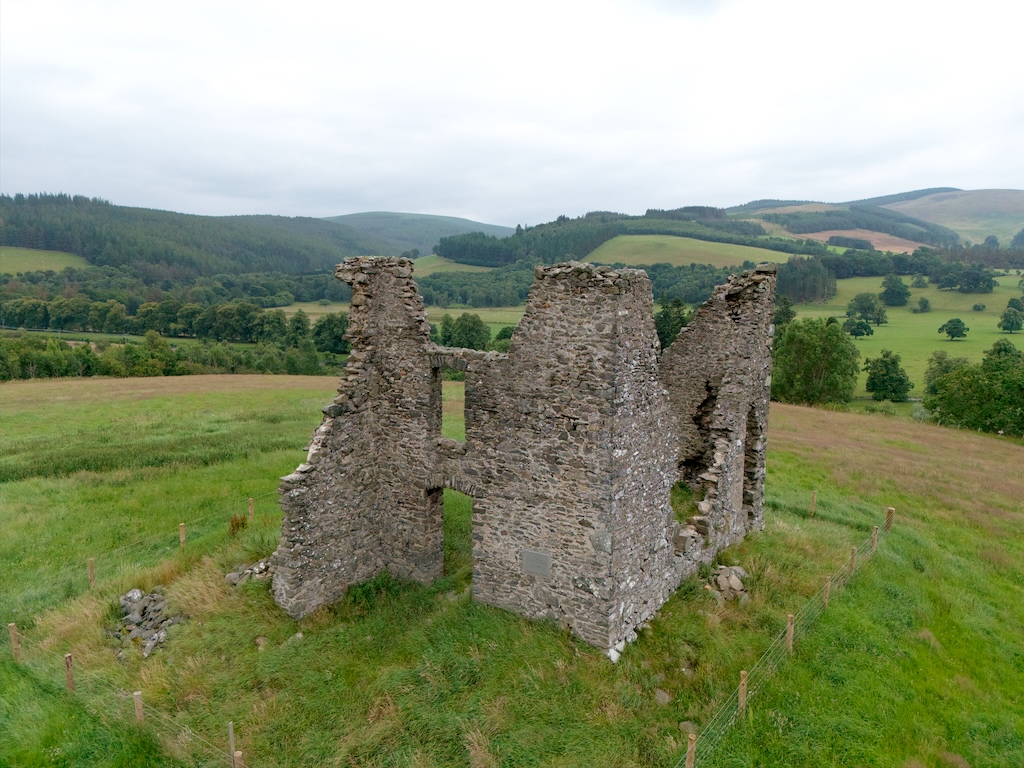
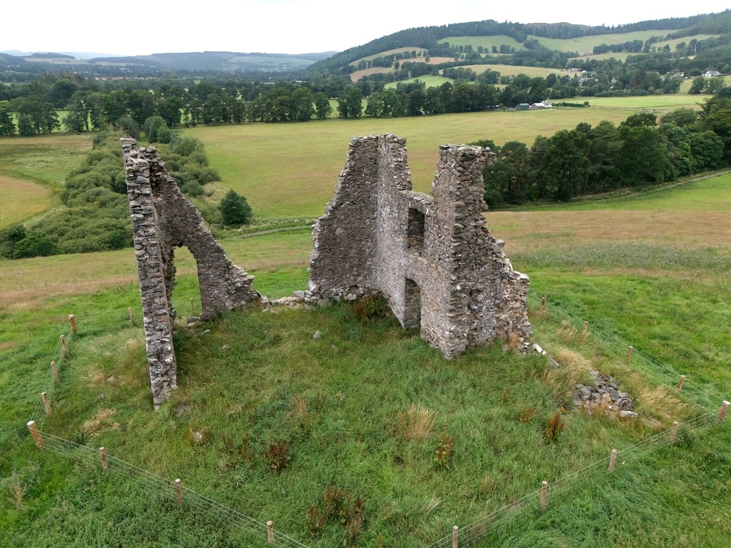
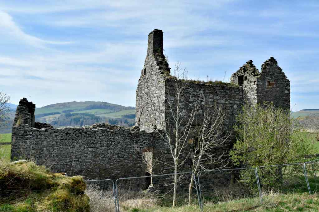
Horsburgh Castle (also known as Horsburgh Tower) sits on top of a hill roughly two miles (3.2 km) east of Peebles, overlooking the gentle sweep of the River Tweed. From this vantage point, the 16th-century tower would have dominated the surrounding countryside. It served as the ancestral seat of the Horsburghs for generations, and was a vital link in a 16th-century beacon chain to alert the Borders of raiders.
The Horsburgh family first surfaced in local records in 1230, when a Symon of Horsbroc witnessed a charter at Melrose Abbey. In 1297, that same Simon paid homage to Edward I of England. Around that time, changing loyalties during Scotland’s Wars of Independence saw his lands forfeited and then returned.
By 1479, the estate was in the hands of Alexander Horsburgh. It was subsequently divided into “Over Horsburgh” (the eventual site of Horsburgh Castle) and “Nether Horsburgh”.
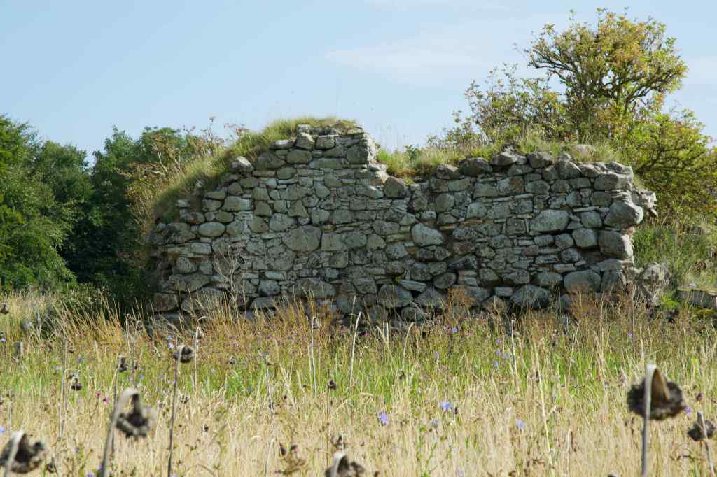
Then, between 1529 and 1555, John Horsbrugh undertook a substantial rebuild, fashioning the castle into a sturdy L-plan tower house, the ruins of which can be seen today. He also built the 16th-century tower house at nearby Nether Horsburgh.
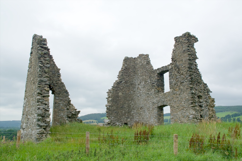
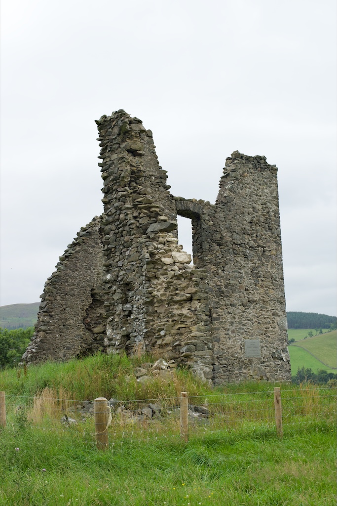
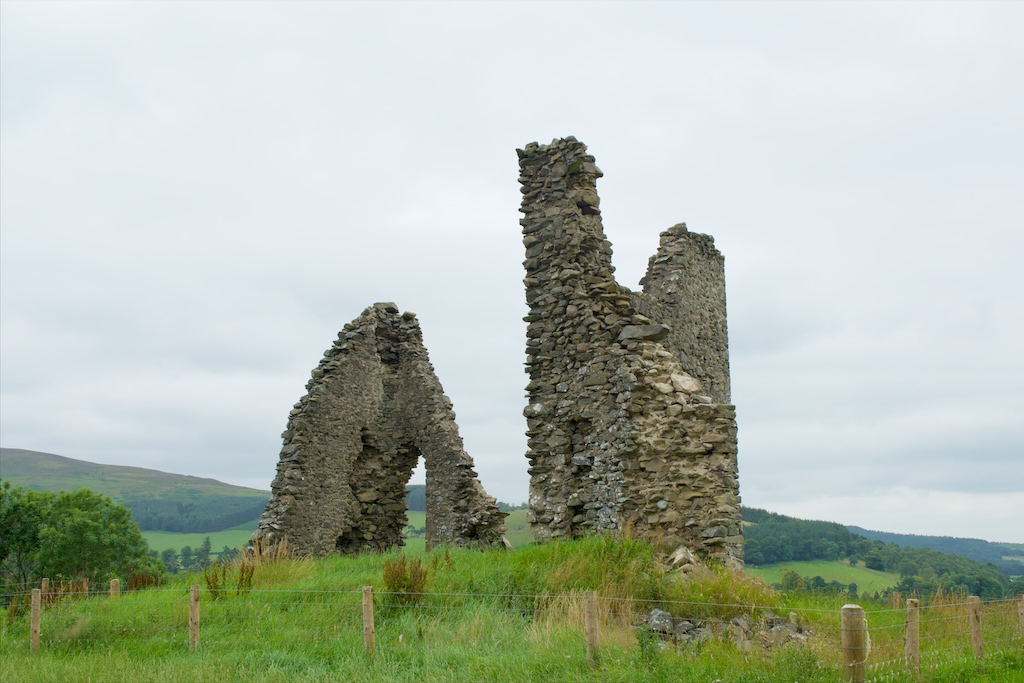
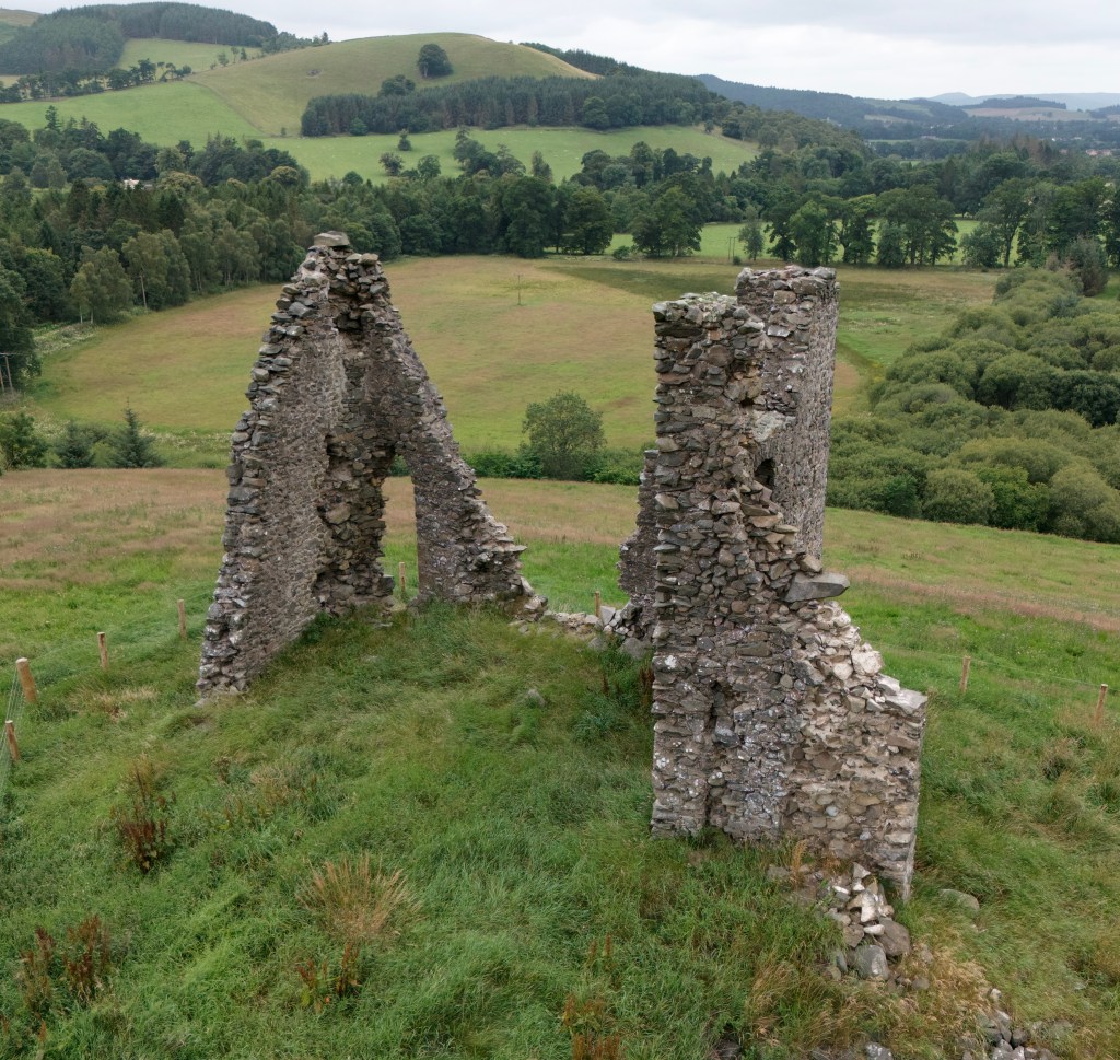
Today, only the shell of Horsburgh Castle remains. The main block measures 9.5 metres by 10 metres, while the wing extends to 2.5 metres. The whole of the eastern wall has disappeared, together with part of the south wall. The surviving walls are 6.7 metres in height. The castle was built of whinstone rubble, and the exterior walls would have been harled (lime rendered).
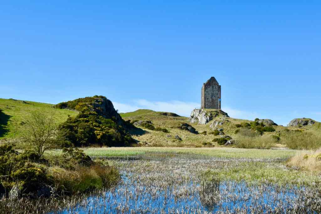
As part of the warning chain of tower houses, a beacon-basket would be lit to signal neighbours. They, in turn, would light their own beacon, sending the warning along the chain. Smoke by day and flame by night would rouse local lairds in minutes. Horsburgh Castle offered a line of sight to Nether Horsburgh Tower, 1 km east and west to Haystoun (This may be the site of the now much-altered, privately owned Haystoun House and Courtyard).
Horsburgh Castle had other strategic advantages. It was well positioned to control the crossing at Horsburgh Ford, a shallow part of the River Tweed, and also to oversee the entrance to the route alongside the Eshiels Burn towards Glentress.
During the 17th century, Horsburgh Castle was the focal point of several violent incidents and legal disputes, reflecting both the family’s declining fortunes and the turbulent state of the Scottish Borders at that time. Alexander Horsburgh, the then-laird, became embroiled in a bitter feud after leasing land to his cousin, Harcus.
This arrangement led to disputes not only within the Horsburgh family but also with rival local families. The situation escalated into court cases, sporadic violence, property damage and intimidation, indicative of the reiving (raiding) culture in the Borders during this period.
Over the years, successive Horsburghs served as sheriff of Peeblesshire. Around 1684, Alexander Horsbrugh married Margaret Tait of the Taits of Pirn, and moved to Pirn House to the east of Innerleithen. Shortly afterwards, it seems that the castle was abandoned.
There were some attempts to partially rebuild the castle walls in the late 19th or early 20th century. Much later, a plaque was attached with the wording, “A memorial to the Rt Hon Baroness Horsburgh of Horsburgh 1889-1969.”
The castle lacks a good ghost story, but it has been claimed that in 1898, labourers digging for building stone found a pot of “pennies” at the foot of the ruin. But whether or not there are ghosts or treasures, the castle has a certain romantic appeal—enough for the artist J.M.W. Turner to sketch Horsburgh Castle in 1834 when he visited the Peebles area. The drawing is part of his collection held at the Tate Britain in London.
To visit Horsburgh Tower we parked in front of the gate just off the A72. From here we walked west along the old road a short distance (75 metres) before we came to a gap in the hedge. The castle was then a short climb up a gentle hill, avoiding the nettles and thistles where possible.
Horsburgh Castle: OS National Grid Reference NT 2851 3916
Further reading
Martin Coventry, 2025, The Castles of Scotland (sixth edition), Goblinshead
Reivers Beacons, Bells and Watchers


Leave a comment