
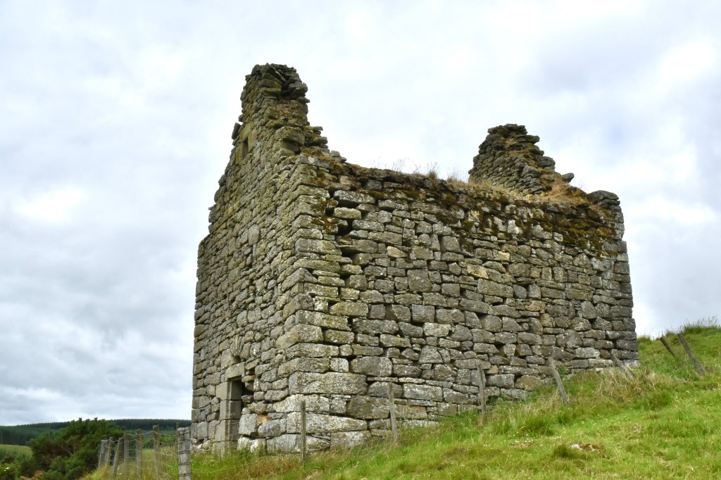
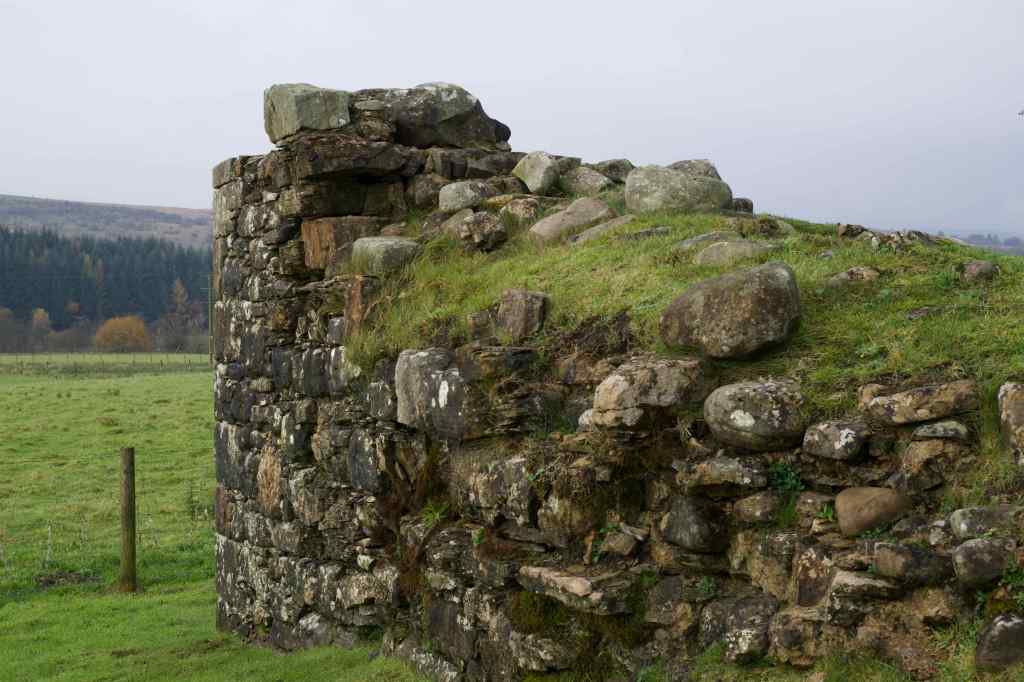
Located on the south slope of Mervins Law near Jedburgh in the Scottish Borders, Mervinslaw Tower illustrates the practical defensive structures built by Border families to protect themselves and their livestock during the Border Reivers era. It is described as a bastle house, a distinctive type of fortified farmhouse that emerged in the Anglo-Scottish Borderlands, particularly during the 1500s.
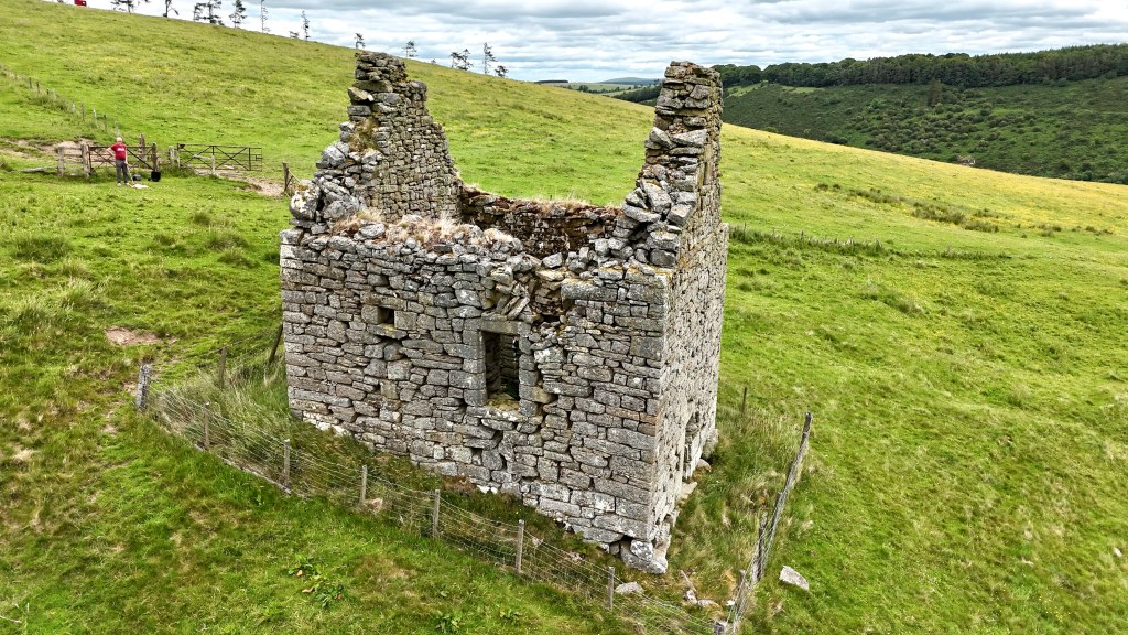
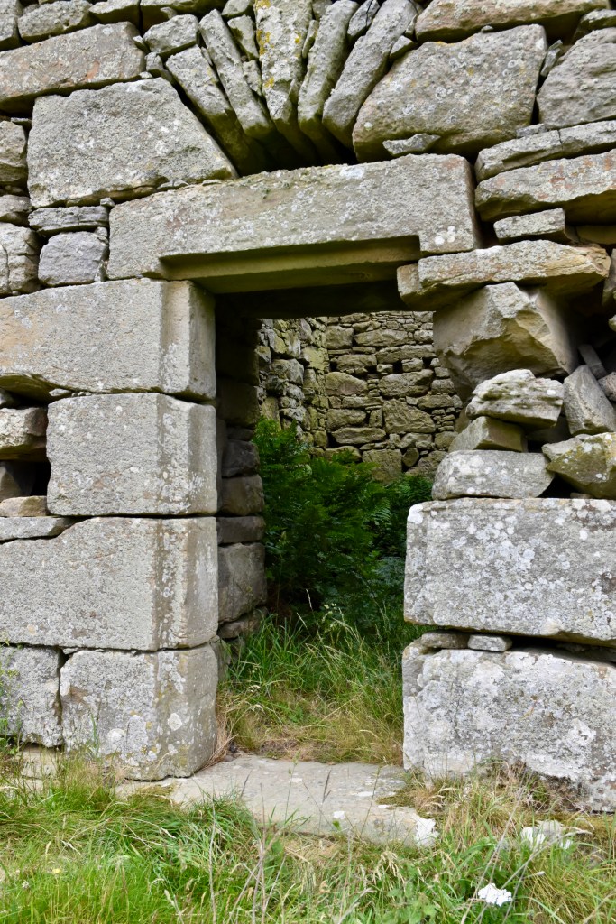
The defensive nature of Mervinslaw Tower is evident in its carefully planned access arrangements. The ground floor entrance is positioned in the south-east wall, providing the primary access point to the lower level, which was likely used as a cattle byre (shed). More significantly, the first-floor living area would have been reached by an external ladder or forestair abutting the south-west wall, where a separate entrance was constructed. This arrangement was a characteristic feature of bastle houses, allowing the upper floor to be accessed independently and, crucially, permitting the removal of the ladder in times of danger to create an effectively impregnable refuge.
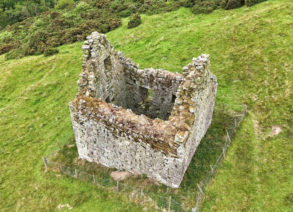
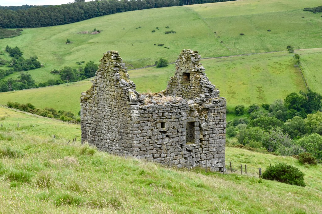
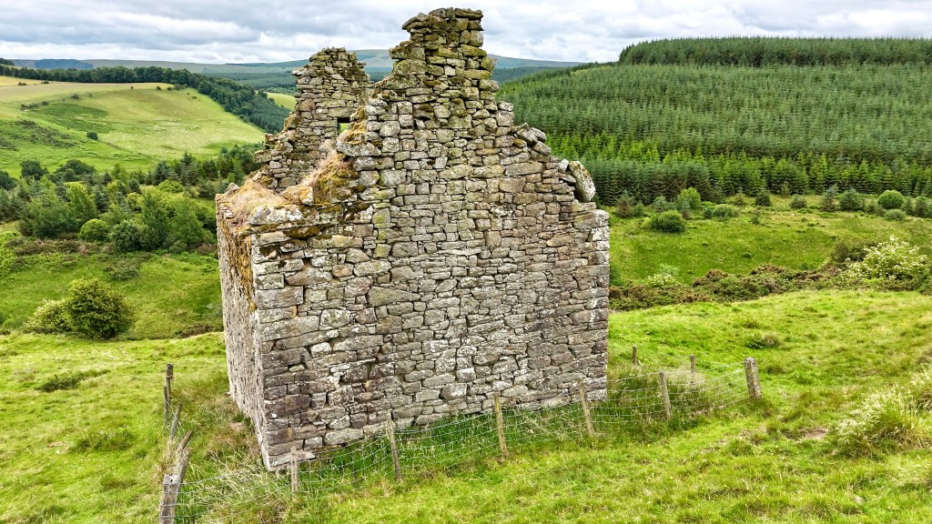
The tower rises to two storeys with an additional garret level, though the roof has long since disappeared, leaving the structure open to the elements. Despite centuries without repair, the building remains remarkably intact, a testament to the quality of its original construction. That said, the entrance on the south-east wall looks precarious, with a series of smaller stones supporting the right-hand side.
The walls are built of roughly coursed rubble set in clay mortar, using materials sourced entirely from the immediate locality. While the building is compact, measuring 7.8 metres by 6.4 metres, its walls are as much as 1.2 metres thick in places.
The construction and occupation of Mervinslaw Tower is linked, historically, to the Oliver family, known to be prominent Border Reivers. The Olivers may have used Mervinslaw Tower as part of a network of Border strongholds in the Jedburgh area during the 16th century, along with nearby towers such as Slack’s Tower, Dykeraw, Northbank, and Kilnsike.
No records mention specific raids on Mervinslaw Tower, but it would certainly have faced threats. Indeed, feuds with other reiving families were not uncommon and may well have involved the Olivers. What’s more, during the Wars of the Rough Wooing, the English devastated large areas of the borders, so it is possible that Mervinslaw endured attacks, even if unrecorded. However, since the Olivers were among the Assured Scots who fought on the side of the English, it is perhaps also possible that the tower escaped unharmed.
Reaching Mervinslaw Tower can be challenging. Five miles south of Jedburgh on the A68, take the minor road on the right towards Mervinslaw and Chesters. After about 1.25 miles (2 km), there is a farm track. From here, it is a case of walking uphill on a very uneven surface, avoiding sheep or other livestock. Once you reach the top, head in a southeasterly direction down the other side, and the tower should come into view. The walk will take about 20 minutes. Although mostly grassland, it is very uneven, so care is needed. As with all such walks, appropriate footwear is advised.
Mervinlaw Tower is a fascinating historic monument. As a survivor from the Border Reivers period, it offers insight into the defensive strategies employed by wealthier border families during one of the most lawless periods of history.
Mervinslaw Tower: OS Map Grid reference NT 672 117
Further reading
Mike Salter, 1994, The Castles of Lothian and The Borders (Folly Publications)


Leave a comment